
 Contact


When
Date From 19.09.2001 to 11.10.2001
Where
Institut Cartogràfic de Catalunya
Parc de Montjuïc
08038 Barcelona
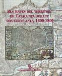
Under the title, The maps of the Catalonia's territory during two hundred years: 1600-1800, the Map Library organized an exhibition within the frame of the acts planned on occasion of the XXII International Congress of the Association Internationale de Bibliophilie, which was held in Barcelona on September 16-22, 2001.
According to their title, the whole maps of Catalonia that are known actually were exhibited -the Principality of Catalonia as a whole, never partially- which represent an amount of 64, and in their first edition, when it was possible. This condition was fulfilled in almost the 90% of the fund. Joining this choice involved the collaboration of different documentary centers as well as private collectors. The Map Library, under these previously established conditions, was able to collaborate with an amount of 15 pieces. As a testimony, we have the catalogue which reproduces the 64 maps, carefully catalogued and documented.
The Exhibitions Hall of the ICC was the venue of the exhibition, and it was opened to general public from September 19th till October 11th, it had a great echo in the media and almost a thousand people visited it.
A catalogue has been published related to this exhibition. It can be purchased printed on the ICGC's e-shop or download in PDF.
