
 Contact


Measurement of field points for sensor calibration for Z / I Imaging GmBH (2016)
The German company Z / I Imaging GmbH (Z / I) requested the ICGC to measure 81 field control points located in Reus (Baix Camp), in order to use them for the calibration of sensors of the company Leica Geosystems.
Institut Cartogràfic i Geològic de Catalunya (ICGC); Z/I Imaging GmbH, Germany.
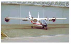
CENSAT (2015)
The ICGC signed an agreement with the Universitat de Barcelona (UB), the Universitat Politècnica de Catalunya-BarcelonaTech (UPC) and the University of Florida, to create in Barcelona the Centre de Tecnologies i Aplicacions per a Microsatèl·lits (CENSAT). CENSAT will be a center for analysis, design of technologies and exploitation of scientific and commercial applications for microsatellites.
Institut Cartogràfic i Geològic de Catalunya (ICGC); Universitat de Barcelona (UB); Universitat Politècnica de Catalunya-Barcelona Tech (UPC); University of Florida, USA.
Digital flight over the Marseilles-Geneva gas pipeline (2006)
The ICC made a digital photogrammetric flight covering the Marseilles-Geneva gas pipeline, with a ground pixel size of 20 cm. In addition, the captured images were processed and the flight trajectories calculated.
Institut Cartogràfic de Catalunya (ICC); SETIS, Groupe Degaud, Grenoble, France.
Financed by: SETIS.
Digital flight over the département of Lot (2006)
The ICC made a digital photogrammetric flight covering the département (administrative division) of Lot in France, with a ground pixel size of 50 cm. In addition, the captured images were processed and the flight trajectories calculated.
Institut Cartogràfic de Catalunya (ICC); Alpes Pyrenées Images, Groupe Degaud, Grenoble, France.
Financed by: Alpes Pyrenées Images, Groupe Degaud, Grenoble, France.
Comparative analysis of LIDAR data captured at 6 000 meters (2006)
The aim of this project was to exchange experiences in the calibration and processing of LIDAR data obtained at this altitude.
Institut Cartogràfic de Catalunya (ICC); Instituto Nacional de Estadística, Geografía e Informática (INEGI), Mexico.
Financed by: Instituto Nacional de Estadística, Geografía e Informática (INEGI), Mexico.
Digitalization of aerial photography for digital data capture (France) (1995-1997)
The appearance of photogrammetric systems that work on images is giving rise to agreements to digitalize the analogical information contained on aerial photographs. The tool for performing this task is the photogrammetric scanner, in the case of the ICC, the Intergraph PS1 and TDSCAN systems. This systems are capable of digitized images with differents resolutions and with a contrasted accuracy of 4 µm. Once the aerial photographs are digitalized, it is possible to visualize them by means of 2D or 3D photogrammetric stations, perform the same tasks as could be performed with the analytical systems and also take advantage of the capacity for process automation made posible by working with digital tools, such as the automatic extraction of terrain elevation models or the semi-automatic survey of cartographic objects, for example.
Institut Cartogràfic de Catalunya (ICC); Institut Géographique National (IGN), Paris, France.
Financed by: Institut Géographique National (IGN), France.
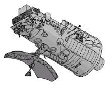
GEOCAL (1995-1997)
Research project whose aim is the periodic geometric in flight calibration of the MOMS-2p camera throughout the mission on which it will be on board the PRIRODA module of the MIR orbital station. After studying the characteristics of the sensor and the associated data provided by the DLR, the images orientation model will be established, which will be validated using images from previous missions, and a geometric in flight calibration model will be defined.
Institut Cartogràfic de Catalunya (ICC); Oberpfaffhofen Institut für Optoelectronik of the Deutsche Forschungsanstalt für Luft- und Raumfahrt (DLR), Munich, Germany.
Financed by: Undertaken jointly by the participating institutions.
LPFICC (1995-1997)
Research project to evaluate the cartographic potential of the MOMS-type three line sensors using a software prototype to perform image orientation by means of point transfer and orbit determination techniques. The stages of the project were: construction of the prototype; aerial triangulation of a block of MOMS images over Catalonia; evaluation of the cartographic potential.
Institut Cartogràfic de Catalunya (ICC); Lehrstuhl für Photogrammetrie und Fernerkundung, Munich, Germany.
Financed by: Undertaken jointly by the participating institutions.
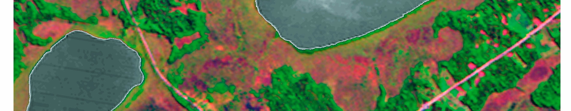
Evaluation of the photogrammetric capacity of the MOMS (Bolivia) (1995-1996)
The MOMS sensor is an instrument that combines the capacity to capture multispectral images with the capacity to capture stereoscopic images. This latter facility led to agreements with the German DLR in order to obtain images captured during the flight of the space shuttle over Bolivia, and with the Instituto Geográfico Militar de Bolivia in order to obtain pass and test points for the orientation of these images. The aims of the work of the ICC are: to adapt a geometric deformation model of the sensor, extract the terrain elevations model through the stereoscopic capacity of the sensor and construct an orthoimage of the area.
Institut Cartogràfic de Catalunya (ICC); Instituto Geográfico Militar de Bolivia, La Paz, Bolivia; Deutsche Forschungsanstalt für Luft- und Raumfahrt (DLR), Munich, Germany.
Financed by: Undertaken jointly by the participating institutions.
Venezuela (1994)
Project to demonstrate the advantages inherent in the use of aerial control for the aerial triangulation of a photogrammetric block, especially in areas where the determination of ground control points is difficult and extremely costly. The project was conducted in the following stages: establishment of a reference station for subsequent processing of the aerial GPS (Global Positioning System) observations; postprocessing of the GPS data (aerial reference station), and aerial triangulation of the block. Adjustment of a photogrammetric block of 650 photograms at 1:60,000 scale with only 17 ground control points.
Institut Cartogràfic de Catalunya (ICC); Servicio Autónomo de Geografía y Cartografía Nacional (SAGECAN), Ministerio del Ambiente y de los Recursos Naturales Renovables, Caracas, Venezuela; Fundación de Geografía y Cartografía Militar (FUNGECAMIL), Ministerio de la Defensa, Caracas, Venezuela.
Financed by: Undertaken jointly by the participating institutions.
Geometric test of the ERS-1 images over Frankfurt (1993)
Participation in the first phase of the OEEPE-GeoSAR test, which consisted in comparing geometric models for SAR (Synthetic Aperture Radar) images from the ERS-1 satellite. Each of these models contained a set of constants characteristic of the platform and the sensor and another set of parameters which had to be adjusted with external information, normally pass points located on the ground. For the comparison, a same set of data was used, consisting of an image of Frankfurt, the elevations model of the area and some maps for the location of pass and test points.
Institut Cartogràfic de Catalunya (ICC) and other participating institutions: University College London, United Kingdom; Technische Universität Wien, Vienna, Austria; Deutsche Forschungsanstalt für Luft- und Raumfahrt (DLR), Munich, Germany; Thomson CSF, Bagneux, France; Istar, Valbonne, France.
Financed by: Undertaken jointly by the participating institutions.
Aerial control processes for aerial triangulation: Gambia (1993)
Project to demonstrate the advantages represented by the use of aerial control points for aerial triangulation of a photogrammetric block. Adjustment was made of a photogrammetric block of 515 photograms at 1:50,000 scale with only 22 ground control points.
Institut Cartogràfic de Catalunya (ICC); TopScan, Stuttgart, Germany.
Financed by: TopScan, Stuttgart, Germany.
Fairfield - Aerial triangulation with GPS (1992)
Project to demonstrate the use of the kinematic techniques of the GPS (Global Positioning System) to provide aerial control points for the orientation of sensors in the Fairfield block (California).
Institut Cartogràfic de Catalunya (ICC); TopScan, Stuttgart, Germany.
Financed by: TopScan, Stuttgart, Germany.
An assessment of the European technical capability for the treatment and interpretation of satellite earth observation data (1991)
The aim of this project was to promote a higher degree of development of the satellite telecommunications industry, to determine the reasons behind the scant activity of companies specialising in remote sensing in Europe and to provide suggestions aimed at optimising the capacity of the European groups to extract relevant information from the Earth observation satellites. The considerable investment that European countries make in order to launch and monitor these satellites is not matched by the demand for the images that are produced, unlike what has occurred in the field of satellite telecommunications.
Institut Cartogràfic de Catalunya (ICC) and other participating institutions: Smith Associates, London, United Kingdom.
Financed by: European Union.
Urgell test - Aerial triangulation with GPS (1990-1992)
Research project to analyse the characteristic errors of the kinematic GPS (Global Positioning System) in an operating environment. The following stages were completed: conditioning of the aircraft in order to install an aerial and a GPS receiver; test planning and flight; processing of the data and aerial triangulation of the photogrammetric block; definitive evaluation of the results and presentation at various forums.
Institut Cartogràfic de Catalunya (ICC) and other participating institutions: Institut für Photogrammetrie, Stuttgart, Germany; technique attendance of the Rijkwaterstaat, Delft, The Netherlands.
Financed by: Undertaken jointly by the participating institutions.
AT-DTM: Aerial Triangulation with Digital Terrain Model (1989-1990)
Project to investigate aerial triangulation supported by terrain elevation models. From the simulations made it was deduced that the use of Digital Terrain Models (DTM) in aerial triangulation is advisable in applications based on satellite images, when control points are too expensive, and also in applications that require DTM for other uses.
Institut Cartogràfic de Catalunya (ICC) and other participating institutions: Lehrstuhl für Photogrammetrie und Fernerkundung, Munich, Germany.
Financed by: Undertaken jointly by the participating institutions.
