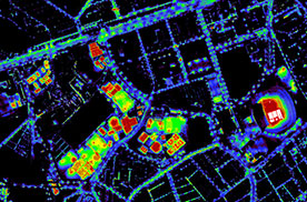
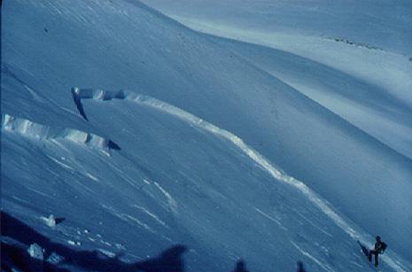
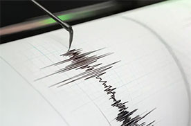
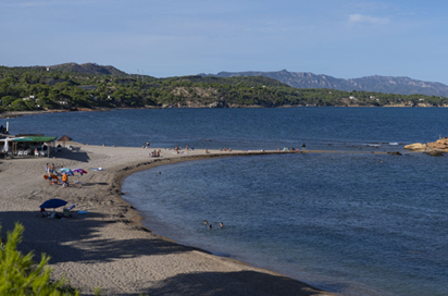
Explora Catalunya Visor VISSIR 4 Terratrèmols Terratrèmols i informació sísmica Participem al Space Economy Congress 2026 per debatre els usos de les dades d'observació de la Terra Memòria 2025: el VISSIR 4, els bessons digitals urbans, el SIDL i el reforç de la vigilància dels riscos naturals, com a principals fites La temporada hivernal 2025-2026 es tanca amb més d’un miler d’allaus al Pirineu de Catalunya Celebrem l’acte d’inauguració de la nova estació sísmica de la Granja d’Escarp Explora Catalunya Visor VISSIR 4 Terratrèmols Terratrèmols i informació sísmica Participem al Space Economy Congress 2026 per debatre els usos de les dades d'observació de la Terra Memòria 2025: el VISSIR 4, els bessons digitals urbans, el SIDL i el reforç de la vigilància dels riscos naturals, com a principals fites La temporada hivernal 2025-2026 es tanca amb més d’un miler d’allaus al Pirineu de Catalunya Celebrem l’acte d’inauguració de la nova estació sísmica de la Granja d’Escarp Propers esdeveniments VI Jornades Tècniques de Neu i Allaus Data 22.10.2026 http://www.icgc.cat/ca/LICGC/Agenda/VI-Jornades-Tecniques-de-Neu-i-Allaus Geoinformació i mapes Servei de Mapa Base Adreces municipals Referencial Topogràfic Territorial LiDAR Territorial Ortofoto Territorial Cobertes del sòl Divisions administratives Geoinformació en línia (Geoserveis) Mapes municipals Nomenclàtor Més situacions Eines i visors Imatges del satèl·lit Menut VISSIR 4 API Territorial Catalunya Offline Connector QGIS Open ICGC Fototeca de Catalunya Geocodificador ICGC Geoíndex Instamaps Visor de descàrregues Més situacions Temes destacats Observació de la Terra Allaus Terratrèmols Litoral Som ICGC Posicionament Territori sostenible Botiga electrònica
VI Jornades Tècniques de Neu i Allaus Data 22.10.2026 http://www.icgc.cat/ca/LICGC/Agenda/VI-Jornades-Tecniques-de-Neu-i-Allaus