
 Contact

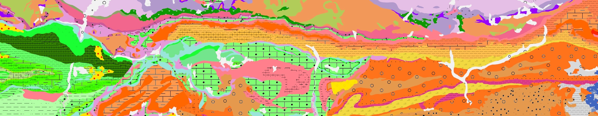


Geological map of Catalonia, scales 1: 250,000 and 1: 50,000
Mitjançant els geological maps 1: 50,000 and 1: 250,000, the ICGC provides the users with geological information of continuous reference of the whole territory of Catalonia, through the Geoindex Geological Cartography viewer.
The Geological Map of Catalonia at a scale of 1: 50,000 is a continuous synthesis made with the information from the geological maps of the MAGNA series at a scale of 1: 50,000 of the Geological and Mining Institute of Spain and the explanatory reports that accompany and complement them. The set of geological information refers to the BT50M topographic base in force in 1997.
The Geological Map of Catalonia at 1: 250,000 scale shows in a synthetic way the geological constitution of the entire territory of Catalonia, based on the definition and description of 228 cartographic units and the representation of the major structural elements. Corresponds to the cartography of the second edition of the Geological Map of Catalonia 1: 250,000 of the year 2003.
Legend of the Geoindex viewer Geological cartography [PDF, 3 MB; Catalan; April 2022]
