
 Contact


As stated in the preamble of the Law 19/2005 of 27th December about the Institut Geològic de Catalunya, the geological map of Catalonia is designed as a fundamental tool for the exercise of the functions that this same Law entrusted to the Institute: study, advice to government and society in general, research and information on soil and subsoil, which constitute an indispensable tool to promote the various policies and actions, both public and private, focused on the ground, and to establish preventive or corrective measures in situations of geological risk.
Strictly speaking, a geological map is a cartographic document using a topographic map in support for information about geology, soils or other geological subjects (geothematic); in which map is graphically represented the physical constitution of the soil and subsoil, many properties of materials that form them, its behavior and dynamics, or the resources it contains. In a general sense, a geological map is a set of sets of geological, soils or geothematical information represented above topographic mapping support.
As ordered in the Decree Law for partial deployment of the Institut Geològic de Catalunya (November 3rd, 2009), the main goal of the Geological map of Catalonia is to provide to citizens and government geological, soils and geothematic documents formally complete and homogeneous, appropriate to support the territorial and urban planning, the execution of public works, the prevention and risk management, as well as the rest of activities that require geological, soil or, generally geothematical. The Geological map of Catalonia is done at typical scales of urban and regional planning, as well as any other appropriated scales.
On January 30th 2014, it has been published the Law 2/2014, of creation of the Institut Cartogràfic i Geològic de Catalunya (ICGC) and suppression of the Institut Cartogràfic de Catalunya (ICC) and the Institut Geològic de Catalunya (IGC). This new institution becomes operational on February 1st 2014.
Their duties are related to the competences of geodesy and cartography and about the spatial data infrastructure of Catalonia, and also the competences of promoting and carrying out the actions related to the awareness, survey and information about the soil and subsoil, as regulated by the Law 16/2005, of December 27th, on geographic information and the Institut Cartografic de Catalunya, and by the Law 19/2005, of December 27th, on the Institut Geològic de Catalunya.
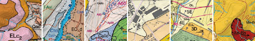
The Decree Law determines that the contents of the Geological map of Catalonia, at least include the following documents:
- I. Geological map 1:25.000
- II. Map of active and recent processes and human activity 1:25.000 (Geoanthropic)
- III. Geological map of urban areas 1:5.000
- IV. Soil map 1:25.000
- V. Hydrogeological map 1:25.000
- VI. Map for the prevention of geological hazards 1:25.000 (information system and map of geological hazards)
Each of these documents or map series, represents an "information layer" and the whole of the six layers of information is the geological map of Catalonia. The system used by the Cartographic and Geological Institute for their realization is called "Geoworks".
All documents or map series presented at 1:25.000 cover the entire surface of Catalonia (31895 km2) divided into 304 sheets, while the Geological map 1:5.000 for urban areas includes the towns of the municipalities with more than 10,000 inhabitants and all county capitals.
The geological, soil and geothematical information is obtained and prepared by the ICGC, in collaboration with other entities of the Generalitat and Local Government.
The topographic layers for supporting geothematic information are, for the series at 1:25.000, the 1:25.000 topographic map of Catalonia, with its cartographic division in 304 sheets; and for 1:5.000 scale series, the 1:5.000 topographic map of Catalonia. The sheets are self-consistent documents that contain all the information necessary for its correct reading and interpretation. The geological items represented on a map sheet have continuity in the nearby sheets.
Publication of the map series is done jointly with other agencies and departments of the Generalitat (Catalan Water Agency, for GeoWork V: Hydrogeological map; and the Ministry of Agriculture, Livestock, Fisheries, Food and Natural Environment, for GeoWork IV: Soil map).
The usefulness of sheets that make up these map series is to provide an overview of the geological environment and the appearing dynamics, providing a framework that facilitates planning of studies and specific work actions to be performed at the scale of projects.
- Having a geological map, soil map or geothematic map, at scales 1:25.000 and 1:5.000 or smaller, does not exempt under any circumstances to perform studies and detailed analysis at local scope, all needed for execution of building works, public works, for the exploration and mining of soil and geological resources, and for the prevention of geological hazards at the town scale.
In this sense, must take into consideration the provisions of the Town Planning Law (Legislative Decree 1 / 2005 of 26 July, approving the revised text of the Town Planning Law) and Decree that develops it (Decree 305/2006 of 18 July, approving the Regulations of the Town Planning Law.
